
|
|
|
|
|
|
|
|
|
|
|
| Primary Quantities Measured with System Typical |
|
|
|
|
Our first Whole Sky Imagers used spherical mirrors. An early system is shown in use in the photo below, taken during a field test in 1963.
Although mirrored systems such as this are still in use today, we found that the design was somewhat limited, because the mirror tended to degrade, and if the full surface of the sphere is not shaded, the measurements are adversely impacted by stray light.
During the C-130 program discussed on this web site, a combination of cameras with fisheye lenses and scanning radiometers were used to document the sky and terrain. The fisheye systems took pictures of the upper and lower hemisphere (above and below the aircraft) at high resolution, and the scanners provided radiometrically calibrated data at approximately 5 degree resolution in zenith angle and 6 degree in azimuth angle.
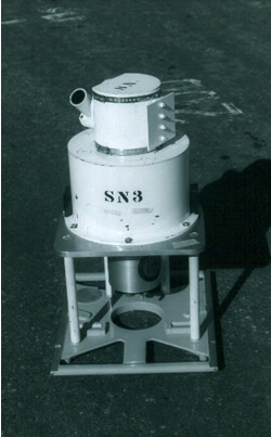
The scanner system is shown below. Typical plots of the radiance distributions may be seen in the Overview: History: Image Transmission section of this web site.
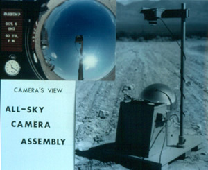
The head of our group at the time, Richard Johnson, had the idea of combining the capabilities of the fisheye cameras and the scanning radiometers by using a solid state digital CCD camera in conjunction with a fisheye lens and appropriate sun shades, and calibrating the CCD cameras to provide radiance distribution. Furthermore, by using two filters, a red and a blue, we could use the ratios of the calibrated signals in each pixel to identify clouds (relatively high red/blue ratio) and clear sky (low red/blue ratio) within the image.
Our initial digital WSI systems were first developed and fielded in the early 1980’s. By the mid to late 1980’s, a series of fully automated digital WSI systems had been designed and built, and were deployed at several sites throughout the continental US.
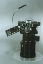 |
The picture shows the primary sensor. Note the equatorial occultor, to automatically shade the sun, the lens housing, filter changer, and camera housing, which were all purged with dry nitrogen to protect the optics. |
This system was housed in an environmental housing, and fielded in environments such as Montana (including all winter), the deserts of California and New Mexico, and in the moist environement of Florida. The system was controlled by an early PC computer, with electronics designed and built by MPL to control the peripherals such as the filter changer.
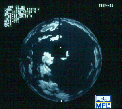
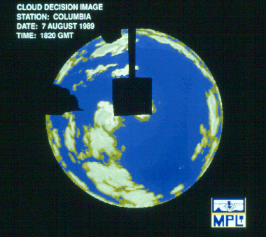
Sample raw and processed data are shown below.
 |
 |
Data were acquired at full resolution every 10 minutes, and reduced resolution every minute. They were processed through QC routines within a few days at MPL. Approximatly 1 year of data from 4 sites at 1-minute resolution has been processed and evaluated to yield Cloud Free Line of Site statistics, as discussed in the Related Research section of this web site. See the References section, for several references on this instrument.
![]()
Produced
by the Marine Physical Laboratory, SIO.
Send questions, comments and suggestions about the Atmospheric Optics
Group website to:
webmaster@mpl.ucsd.edu
Copyright © 2002.
| Official web page of the University of California, San Diego |